 |
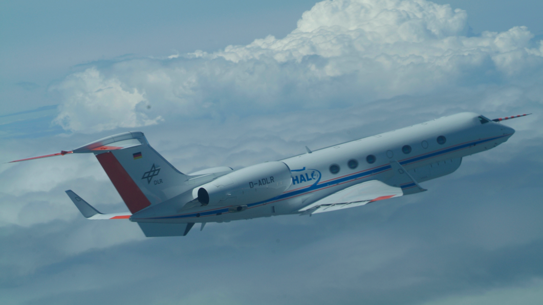
| An additional container for scientific instruments is installed underneath the fuselage and wings, Credit: DLR (CC-BY 3.0). |
Clouds can both warm and cool Earth's atmosphere. In current climate models, detailed conditions for cloud cover as a climatic factor are still not clearly understood. There is a shortage of precise measurements on how the water, humidity, ice particles and aerosols that form water droplets are distributed in towering cumulus clouds. HALO, the High Altitude and Long Range Research Aircraft operated by the German Aerospace Center (Deutsches Zentrum für Luft- und Raumfahrt; DLR), can overcome these limitations and acquire measurements of clouds over large distances and at very high altitudes above the Atlantic. Precipitation is also measured. A total of three flights from the DLR site in Oberpfaffenhofen to Barbados are scheduled between 10 and 25 December. This will be the first HALO measurement flight focusing on cloud research. DLR staff, colleagues at the Max Planck Institute for Meteorology (MPI-M), the University of Hamburg, the Universities of Cologne, Leipzig and Heidelberg and the Jülich Research Centre (Forschungszentrum Jülich) will all be taking off from Oberpfaffenhofen en route to the Caribbean island. Scientific leadership of the measurement flights is in the hands of the MPI-M, which is sending two of its renowned cloud researchers on the mission – Bjorn Stevens and Lutz Hirsch. HALO is a collective initiative involving German environmental and climate research institutions.
 |
| Additional containers for scientific instruments can be attached under the fuselage and under HALO’s wings; Credit: DLR (CC-BY 3.0). |
"With the research flights about to be conducted over the Atlantic, we are adding another chapter to the use of HALO," says head of DLR research flight operations Oliver Brieger. "During the 10-hour direct flight, HALO will once again demonstrate its capabilities as a research tool through its unrivalled range and flying altitude – this time in the area of cloud research."
Lasers measuring clouds
The current flight is part of the NARVAL (Next-generation Aircraft Remote-Sensing for Validation Studies) project, which is aimed at giving atmospheric researchers detailed information on the composition of tropical clouds. The flights across the Atlantic from Oberpfaffenhofen to Barbados will build on the static observations at the cloud observatory there. Measurements with the LIDAR (Light Detection and Ranging) measurement device developed at and operated by the DLR Institute of Atmospheric Physics will also be making important contributions here. "Besides the distribution of moisture in the atmosphere, we will be using laser measurements to obtain information on particles suspended in the air," says Markus Rapp, Head of the DLR Institute of Atmospheric Physics. "These particles, known as aerosols, have a direct effect on the formation of clouds." The data will contribute to a better understanding of cloud and precipitation processes. LIDAR and other remote sensing measurement devices, both within the aircraft and installed in the 'belly pod' underneath the aircraft fuselage, will determine vertical profiles for the temperature and humidity, as well as the distribution of cloud droplets and aerosols. What are known as 'dropsondes' will also be released during the flight. These radio probes normally ascend from the surface under a weather balloon and measure the wind, temperature and humidity on their way up through the atmosphere. In this case, they will be released and will make their way back to Earth with a parachute.
Flight in parallel with a satellite
On the flights to and from the island of Barbados, and with the MPI-M cloud observatory there, the scientists ideally want to run comparison measurements with the CloudSat satellite as well. The satellite monitors the cloud cover above the Atlantic in strips transverse to the line of flight. The short flights of HALO, in parallel to these satellite strips, will enable the satellite's measurements to be checked. This is because the aircraft will be flying at a significantly lower altitude and will have a much better view of the clouds. The first three flights between Oberpfaffenhofen and Barbados form the 'NARVAL South' part of the mission. For the second flight, a local trip is planned – the aircraft will head east from Barbados through the trade wind cloud cover. The aim is to capture data on clouds that are moving towards the Barbados measurement station and compare the measurement flight data with the data from the ground measurement station.
Second measurement campaign above the North Atlantic
The second part of the mission, 'NARVAL North', will commence in January, under the direction of the University of Hamburg. HALO will be stationed in Iceland for this, to investigate the rear edge of cloud fronts above the North Atlantic. The flights in the measurement area will be operated along and across the cloud fronts, measuring the structure of the front systems more precisely via the unique combination of active and passive remote sensing methods. There is currently a great deal of debate in the scientific community regarding precipitation levels because satellite observations and model computations give different results. "There is a shortage of measurement data, because no ships travel in these typically stormy zones," explains project leader Felix Ament from the Center for Earth System Research and Sustainability (Centrum für Erdsystemforschung und Nachhaltigkeit; CEN) at the University of Hamburg. "If the HALO mission is successful, it could provide important information that will certainly fill an obvious gap in the scientific picture."
About HALO
The HALO research aircraft is a joint initiative involving German environmental and climate research institutions. HALO is supported by grants from the Federal Ministry for Education and Research (BMBF), theGerman Research Association (DFG), the Helmholtz Association, the Max Planck Society (MPG), theLeibniz Association, the Free State of Bavaria, the Karlsruhe Institute of Technology (KIT), the German Research Centre for Geosciences (GFZ) in Potsdam, the Jülich Research Centre and the German Aerospace Center (DLR).
Contacts:
Falk Dambowsky
German Aerospace Center (DLR)
Corporate Communications
Editor Aeronautics
Tel.: +49 2203 601-3959
mailto:Falk.Dambowsky@dlr.de
Markus Rapp
German Aerospace Center (DLR)
Director of the DLR Institute of Atmospheric Physics
Tel.: +49 8153 28-2521
Fax: +49 8153 28-1841
mailto:Markus.Rapp@dlr.de
Oliver Brieger
German Aerospace Center (DLR)
DLR Flight Experiments facility
Tel.: +49 8153 28-2966
mailto:Oliver.Brieger@dlr.de
Bjoern Stevens
Max Planck Institute for Meteorology
Tel.: +49 40 41173-422
mailto:bjorn.stevens@mpimet.mpg.de
No comments:
Post a Comment
Note: only a member of this blog may post a comment.